Skip to content
Facebook
X
Instagram
Bluesky
Search
Bill's Journey
Bill Terry
About: A Photographer’s Journey
Look at Bill’s Journey…
Contact Me!
Latest
All
,
Personal Perspective
,
Road Trips
,
San Francisco
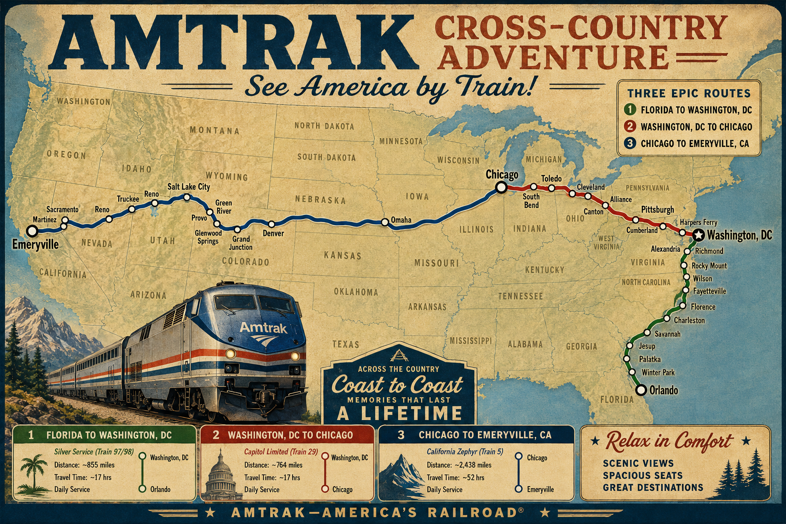
Wayback Journey- 2017 Cross-Country by Train
All
,
Personal Perspective
Sunday Thunderstorms and Live Sports: A Unique Experience
All
,
General
How to look at Bill’s Journey…
All
,
Commentary
Rethink Public Discourse: From Noise to Civility
Categories
All
Around the World 2024
Black & White
Doors
Flowers/ Floral
Food and Drink
Friends and Family
General
Holidays
Home
Night
Old images scanned to digital
Out of business/ Abandoned
Paint/ AI Rendering
Point of View
Bill's Favorites (work in progress)
2008-2010 Favorites
2011-2020 Favorites (work in progress)
2021-2030 Favorites (work in progress)
Commentary
Personal Perspective
The Grand Gnome Empire- Stories and a Rebellion
Signs
Sunrise/ Sunset
Travel
Arizona
Florida
Grand Canyon
Las Vegas
Napa
North Carolina
Out west
Outside the US
Random Places
Road Trips
San Francisco
Loading Comments...
Write a Comment...
Email (Required)
Name (Required)
Website
%d